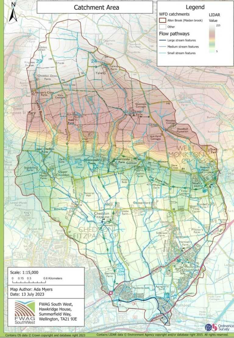
Bathpool has experienced flooding and is at risk of flooding in the future. Three key streams / water courses (Dyers Brook, Allens Brook and Maidenbrook) funnel from the Quantock Hills down to Bathpool into the Old River Tone (illustrated in the picture to the right). Under normal conditions the Old River Tone flows into the River Tone through flap gates. When the River Tone levels are high the flap gates cannot open and instead a pump is deployed to pump the water from the Old River Tone into the River Tone to prevent flooding of homes and businesses.
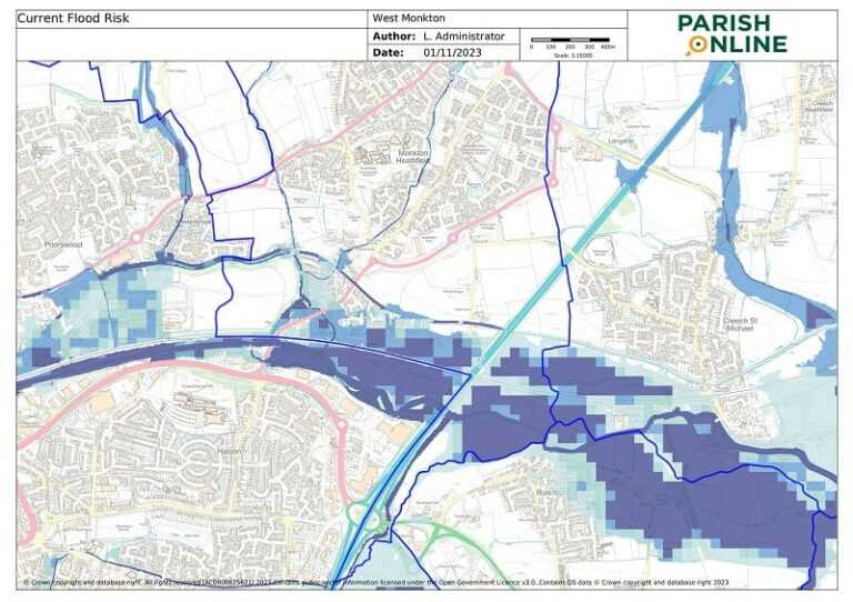
The current flood risk in Bathpool is illustrated in the diagram below.
The Parish Council has established a multi-agency group to develop and take forward a package of projects aimed at reducing flood risk in Bathpool. The group has been meeting since June 2023.
Representation includes the following local stakeholders:
– Volunteer Flood Wardens
– Local estate / landowners including Quantock Hills AONB and Hestercombe House and Gardens.
– The Environment Agency
– Wessex Water
– Somerset Rivers Authority
– Somerset Council
– Taunton Town Council
– Canal and Rivers Trust
– Kingston St Mary Parish Council
– Creech St Michael Parish Council
– Cheddon Fitzpaine Parish Council
– FWAG South West
The Group have developed a proposed package of projects to install measures on Dyers Brook, Allens Brook and Maidenbrook catchment streams to slow the flow of water from the Quantock Hills to Bathpool. A grant funding application has been submitted for funding from the Government NFM Programme. Information about the programme is available here: Natural flood management programme – GOV.UK (www.gov.uk)
Notes from the Meetings of the Multi-Agency Group are available below:
Meeting on 22nd June 2023: Multi-Agency Approach to reducing water pressure in Bathpool Meeting 220623 Notes
Meeting on 20th October 2023: Wider Catchment Flooding Meeting 20th October Notes